Reply With Quote
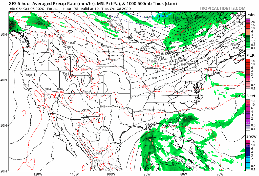
Current model has it touching down in central LA coast but way too early to know.

80 MPH now. Still strengthening. Headed to bed now, clonazepam and my hydrocodone kicking in. Also, Atlanta appears to be getting blown out by the Fudge Packers, so I'm outta here

Current model has it touching down in central LA coast but way too early to know.
Likely a Cat 3 Louisiana landfall.
Already 110 mph and still rapidly strengthening. The brush hit on the yuke peninsula could weaken it a little bit but that part is flat and not mountainous. Will likely be a Cat 4 or 5 hit with a small eye (current forecast is cat 4 but note NHC always errs on the conservative side) on the yuke and then into the GOM as a larger, greater wind field cat 3 with a larger eye and expansive hurricane windfield. Should strengthen back to a 4 or 5 and then weaken back to a 3 before Louisiana landfall (but it will be a very large hurricane by that point due to it being on its 3rd eyewall replacement cycle and baroclinic forces). Similar to Katrina.
It's all about where it hits at this point. It's going to be a major doozy for Baton Rouge and NOLA in any case.


000
WTNT61 KNHC 061520
TCUAT1
Hurricane Delta Tropical Cyclone Update
NWS National Hurricane Center Miami FL AL262020
1120 AM EDT Tue Oct 06 2020
...RECENTLY RECEIVED DATA FROM A NOAA HURRICANE HUNTER AIRCRAFT
INDICATE THAT DELTA HAS RAPIDLY STRENGTHENED INTO A CATEGORY 4
HURRICANE...
Data from a NOAA Hurricane Hunter aircraft indicate that Delta is
continuing to rapidly strengthen. The maximum winds have
increased to near 130 mph (215 km/h) with higher gusts. This makes
Delta a category 4 hurricane on the Saffir-Simpson Hurricane Wind
Scale.
SUMMARY OF 1120 AM EDT...1520 UTC...INFORMATION
---------------------------------------------------
LOCATION...18.2N 82.7W
ABOUT 315 MI...510 KM ESE OF COZUMEL MEXICO
ABOUT 125 MI...200 KM SW OF GRAND CAYMAN
MAXIMUM SUSTAINED WINDS...130 MPH...215 KM/H
PRESENT MOVEMENT...WNW OR 300 DEGREES AT 16 MPH...26 KM/H
MINIMUM CENTRAL PRESSURE...954 MB...28.17 INCHES
$$
Forecaster Brown
130 MPH Cat 4 already
140 MPH Category 4
RIP Cancun

God's really trying to kill Louisiana this year

Cat 3 landfall but will hit nothing but open fields
nah, I think it's going to hit Metairie area pretty much directly.
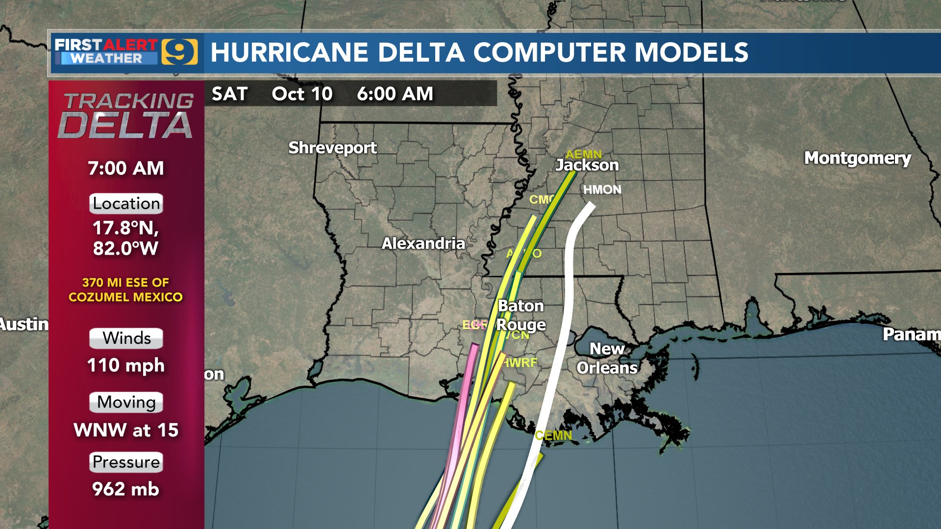
The GFS model and the Euro model are both trending to the west. Euro has it all the way to the LA/TX border.
https://www.wwltv.com/article/weathe...9-73ad9fb5d459
Models at the 5:38 mark
HWRF trending back east.
Models starting to come in agreement. Central or Western LA landfall.

Im guessing its gonna hit somewhere from Lafayette to Baton Rouge. Dont think NOLA will get it.

Yeah, you can pretty much discount the CLP5 which hits Metairie because the CLP5 is a "all else being equal, what would be the standard for October" model, whereas the XTRP model is literally the extrapolated path if it were to continue its exact current motion and speed and not deviate, which is obviously not going to happen.
RIP Lake Charles. Twice in 1 year. Ouch.


Just talked with someone who lives down there and he says about 70% of the houses have temporary roofs on them and it's already 3rd world down there.
supposed to be a cat 3 at landfall with 120 mph winds.
Darth_Pelican you gotta make the game thread this week in the NFL forumchoose an interesting "Sponsored By"
map is posted, on https://506sports.com/nfl.php?yr=2020&wk=5
105 MPH having barely weakened and already emerged off the yuke coast and into the GOM is pretty scary.
Yeah I feel for those in Lake Charles. They're about to get hit again

Bend over, I'll show you getting hit again.
There are currently 1 users browsing this thread. (0 members and 1 guests)
 Posting Permissions