Reply With Quote
not just that, but it sure as seemed like it rained every other day in friggen march and april.Maybe it's because the businesses that we're in, the rain stands out to us more
Musta been a dry February and May.

I figure the rain gods figured I hadn't had enough practice meeting deadline lately.
Last night, we get the game started at 7:37 p.m. and it went 2:56. Had the game started on time instead of having rain at 6:30 p.m., I would have had a nice hour + to get my story right.
Oh, well, can't be good without being under the gun, I guess.

not just that, but it sure as seemed like it rained every other day in friggen march and april.Maybe it's because the businesses that we're in, the rain stands out to us more
Musta been a dry February and May.

It's all gone for now...doesn't look like it's gonna come back anytime soon...this weekend is a toss up however...

Alarms blaring for major flood
Five-day rainfall forecast issued Friday afternoon by the Hydrometeorological Prediction Center.
Flooding alert graphic from the New Braunfels NWS office; click here for full-size version.
With a stationary front to the northwest, an upper-level storm system approaching slowly, and lots of tropical moisture, we are set for a potential major flood, similar to October 1998 and July 2002. Forecasters did not begin to see this potential until late Thursday. Before then, it was just going to be scattered showers, not much worse than what we had nearly a week ago.
The rain Thursday night into Friday morning was just an appetizer, enough to cause a short period of major flooding on the Pedernales River. In western Val Verde County, the Devils River had moderate flooding. The Guadalupe River briefly had moderate flooding at Hunt, then minor flooding downstream. For more details, see the forecast from the West Gulf River Forecast Center.
According to preliminary storm reports, flash flooding occurred in or near Killeen, Fort Worth, Junction, Alice, Edcouch, Elsa, Edinburg, Santa Rosa, Harlingen, San Benito, San Perlita, Raymondville, Kerrville, Del Rio, Bandera, Fredericksburg, Rocksprings, Ingram, Medina, Llano and Round Rock.
As of Friday afternoon, San Antonio International Airport had recorded 1.17 inches for the day, 2.39 for the month and 18.65 for the year. Following are a few NWS volunteer observers’ reports of rainfall for a 24-hour period ending at 7 a.m. Friday: 3.53 in Dallas, 4.15 at Fort Hood, 2.77 at Rio Grande Valley International Airport, 2.91 in Raymondville, 1.23 in the Bulverde area, 5.03 at Fredericksburg, 4.08 near Del Rio, 2.20 near Carizzo Springs, 2.14 near Pearsall, 2.01 at Laredo’s Columbia Bridge, and 4.54 at the Cotulla airport. Radar estimated 8 inches in the Fredericksburg and Kerrville areas.
The disturbance that affected us Friday morning was causing rain over North Texas in the evening, as well as a line of storms that had moved out into the Gulf. South Texas was enjoying a reprieve, but another thunderstorm complex was expected Saturday morning. Forecasters expect more rain off and on through Tuesday.
Most of South and South Central Texas have flash flood watches through Saturday evening, and I expect them to be extended. The New Braunfels forecasters expected 2-4 inches in general and up to 10 inches possible, just through Saturday. As shown in the image above, they expect 5-10 inches average over 5 days, and 20 inches in a few spots.
The image above is a “Graphicast” and this is the first time I have seen the New Braunfels office do one. Some other NWS offices do them either on a daily basis or whenever there is hazardous weather expected.
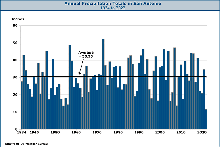
"18.65 for the year."
calendar 07? or last 12 months.
Long term average is 33 inches/year.

I think Manny's prediction actually stopped the rain.

Notice the time of my post. Notice when the Hyrdo center issued their statements.
Carry on.

is it safe to fire up the pit yet?
Scorching Summer Forecast in USA
By Patrick O'Driscoll
USA Today
Tuesday 22 May 2007
Drought to persist in West, Southeast; fire danger a big worry.
Denver - As Memorial Day weekend beckons, federal climate scientists predict drought will intensify in much of the West this summer and persist in the fire-scorched Southeast despite recent rain.
People heading out this holiday to fish and boat in the Southeast could find lakes and reservoirs so low that sandbars and stumps pose hazards. Campers and hikers in the Southwest may see restrictions in national forests dangerously dry from years of drought.
In its drought outlook for June, July and August, the federal Climate Prediction Center foresees some improvement in the Gulf Coast states, including central and South Florida and the state's Panhandle. But southern Georgia and northern Florida, raked by wildfire this month, "may see deterioration" even though the rainy season is due to start, the center reports.
"Fire is the big story," says Mark Svoboda of the National Drought Mitigation Center in Nebraska. "The lack of spring rains has increased fire incidence."
The climate center outlook also expects little lasting relief in dry areas of the West, from California across Nevada and Utah, and new drought areas developing in large parts of Idaho and Oregon.
"It's not good news," says Rick Ochoa, fire weather manager at the National Interagency Fire Center in Boise, which is marshaling up to 20,000 firefighters for summer duty. "The indications now are for a hot and dry June," Ochoa says. "The next question is: How much lightning are we going to get?"
Lightning sparks 70% of wildfires in the West.
Drought, a scourge in the West for nearly a decade, now afflicts about one-third of the contiguous USA, including part of the upper Midwest. The total rises to 49% with areas classified as "abnormally dry." More than 40% of Alaska fits into that dry category.
In the West, 69.5% of the region's 11 states were either in drought or abnormally dry, nearly double the area affected a year ago.
In California and Arizona, which suffered severely below-normal mountain precipitation over the winter, about 90% of each state is in some stage of drought. This time last year, drought touched less than one-tenth of a percent of California. Today, Los Angeles is on track for its driest July-to-July rainfall ever.
The snowpack in California's Sierra Nevada averaged just 29% of normal this winter. Although water left over from last year's spring snowmelt should fill municipal tap water needs this year, another subpar winter could jeopardize California's water supply.
The National Hurricane Center will announce its hurricane forecast Tuesday. Other forecasts envision more storms than normal. The climate center says tropical storms can "break droughts quickly" but cautions that is unlikely in the Southeast because rainfall deficits exceed 1 foot in many areas.
===================
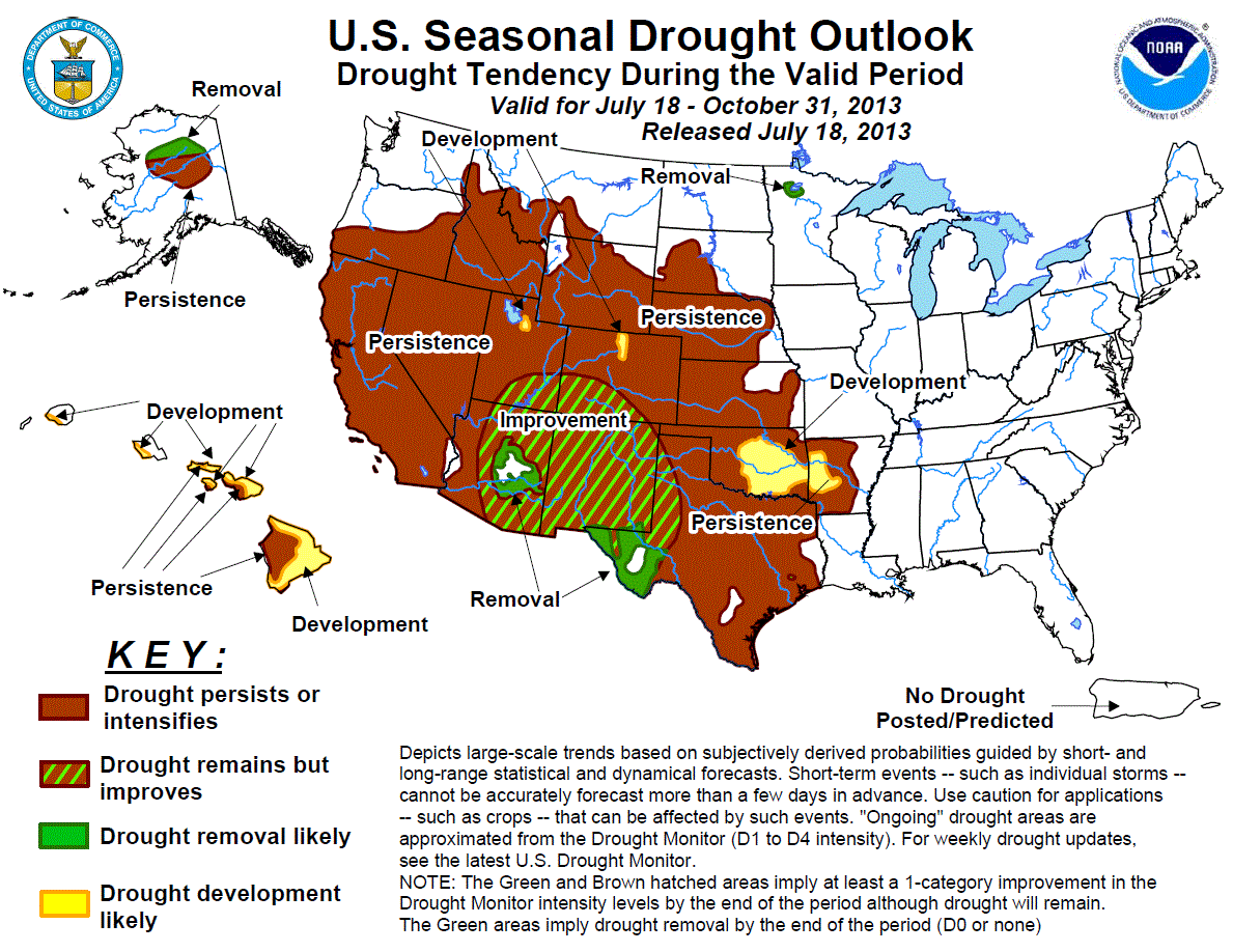
TX drought forecast is "some improvement" (not end of the drought):
==================
Southwest Forecast: Expect 90 Years of Drought
By Andrea Thompson, LiveScience Staff Writer
posted: 05 April 2007 02:00 pm ET
Human-induced change in Earth's atmosphere will leave the American Southwest in perpetual drought for the next 90 years, a new study finds.
Conditions in the southwestern states and portions of northern Mexico will be similar to those seen during a severe multiyear drought in the southwest during the 1950s and the drought that turned the Great Plains into the Dust Bowl in the 1930s.
The southern United States lies in a climatic region called the subtropics, which is dry because "the atmosphere moves water out of those regions," explained study team leader Richard Seager of Columbia University's Lamont Doherty Earth Observatory.
The moist air is transported to temperate regions at higher la udes. The study, published in the April 5 issue of the journal Science, found that as greenhouse gases warm the air, it can hold more moisture, so the atmospheric flow moves more water vapor out of subtropical zones and into higher la udes. The dry areas then become drier, and the wet become wetter.
This flow, known as the Hadley cell, features rising air over the equator and descending air over the subtropics, which suppresses precipitation.
"And that Hadley cell, in a warming world, expands poleward," Seager said, bringing the U.S. Southwest more under the influence of the descending air.
Similar changes in the atmosphere produced past droughts and conditions such as the Dust Bowl, but the study found that the ultimate cause of historic droughts was natural, unlike this projected drought. During those droughts, La Niña, El Niño's cool-water counterpart, brought cooler ocean temperatures to the equatorial Pacific, which resulted in drier conditions over North America.
The researchers used climate models to determine the level of drought based on the amount of evaporation at the ground subtracted from the amount of precipitation that falls at the surface.
The balance between these two processes is what maintains rivers and groundwater flow. As less water is available, water resources become jeopardized.
"The lifeline there is the Colorado River," Seager said, and it and other rivers are already stressed by the 10th year of drought in the Southwest.
As populations in the Southwest increase, governments will have to make adjustments to reduce water usage, but Seager and others unsure just what those changes should be.
========================
From "old Europe", "Long-Range Forecast of U.S. Drought Based on Solar Activity"
http://www.john-daly.com/solar/US-drought.htm
.... shows we are still on the upslope of the current curve.
"Ironically, just drought, the greatest threat attributed to alleged man-made global warming, has turned out to be regulated by variations in the sun’s eruptional activity."
Will that continue to be the case? or will global warming add to the effect of solar eruptions?
========================
And what if the Hurricane Prediction people get it right this year, after totally failing last year?
Could be a weather-dominated summer.
Last edited by boutons_; 05-26-2007 at 10:32 AM.

Rocky is about to Apollo Creed up!
On topic, no more rain. My dogs get muddy paws and it just ruins my day when they jump on me.

you cant really compare the flood of 98 and the flood of 02, and you for sure cant compare them to some fictional 07 flood

I don't think there is going to be a rematch. But what do I know?

I am not being sarcastic here:
We have been in a drought????? It has been raining off and on here in Dallas since late March. The storms here this season have been pretty consistent, wayyyyy moreso than this time last year. But they're really weird, it doesn't just "rain" here, it gets really dark, then winds pick up like no other and it pours so hard that water shoots out of the storm drains straight upward. It's more like a deluge. Never saw that last year, and we've had alot of storms like that here. Last afternoon was the most recent.
What is up with all the storm systems coming from the pacific through mexico to the heart of texas? Is it supposed to happen this often?
lotta history down that road

We actually hadn't had any decent rain in Dallas for two years. Looks like this year Mother Nature has decided to make up for lost time.

way to it up Manny... looks like the Lone Star Shootout softball tourny was cancelled in vein this weekend...
On the bright side, the top-ranked UTSA baseball team was eliminated from the SLC Tournament last night and Texas State needs to beat Sam Houston St. twice today to win the le.
There are parts of the area that are working on 15 inches of rain and itsnot even the end of the weekend.
BTW Mookie, the 02 flood was much worse for certain parts of the area than the 98 flood was but I realize the 98 flood was probably the worse one for Victoria. Medina got hit WAY harder in 02 than in 98.
98 Flood was so bad that Channel One came to victoria (though of course we did not see it cuz school was cancelled, lol)
I just dont get why the rich part of town gets better roads every 2 years and they've still done virtually nothing to alleviate flooding in the little neighborhood around the Guadalupe. ing victoria.
It's 2007 and nothing can be done...sheesh...

Yeah, and even those that got only a few inches...the ground is now saturated. Unless it stays completely dry for days, any new precip will run off.
lol good ole texas clay
The sun being out is just going to heat up the atmosphere which means storms. But the storms that keep forming off the the east inhibit rain from forming here because they take the inflow from the gulf so it never reaches this far.
Either way chances are that it will rain more here and that it will flood more here before the weekend is over.

Manny, it's been pouring for couple of hours here in Houston. I have to think we are getting pretty saturated - is it expected to get worse and continue out here as well?
I don't know.
There are currently 1 users browsing this thread. (0 members and 1 guests)
 Posting Permissions