

 Reply With Quote
Tomorrow (Tuesday) is shaping up to be an epic day on the Great Plains. Looking to bail out of work early and go chasing.

La Nina is gone. The conditions should fade to neutral soon.

Tomorrow (Tuesday) is shaping up to be an epic day on the Great Plains. Looking to bail out of work early and go chasing.
iMap Weather Radio.
Costs about $10, but it's an awesome app. Fires as soon as the National Weather Service issues an alert (watch or warning). You can put in multiple areas if you want to keep an eye on things for friends and family, or just have it configured to work for your area.
Also embeds radar and google maps so you can zoom in and look at the storms, etc.
Really jealous of you. But be careful. This year has even had some experienced chasers scrambling to get out of the way of rapidly forming funnels.
Thanks. Me and one of my buddies are both storm spotters so will be out and about anyway. But we already looked at the forecast this evening and the model runs and discussed going as far as Ardmore tomorrow.
We've seen a funnel or two but otherwise missed out on all the excitement. We err on the side of safety, but as you noted with something so unpredictable nothing is guaranteed.
I'm honestly more worried about the high probability that there's going to be a of a lot of chasers out tomorrow.
There's been an explosion of chasers this year. I think there was over 40 groups (either with chasing websites or TV News chase teams) out on the road today in Oklahoma.
The Storm Chasers teams will also be in action tomorrow from what I've heard (both TIV 2 and Reed with two Dominators), and there's rumblings that the CSWR will have DOWs out tomorrow as well.
Could be an epic cluster on the road, and the last place I want to be with a tornado in the area is stuck in a traffic jam like that.
All that aside, I will say this. if you're reading this and you either live or have loved ones in the I-35 corridor, from north Dallas/Ft. Worth all the way up through south central Kansas, please be sure you (or them) are keeping an eye on the weather tomorrow.
Based on all the model runs tomorrow is setting up to be another April 27 (Tuscaloosa/Birmingham/etc.) type of day. And you've got major cities up and down the I-35 corridor. Stuff's going to be popping all up and down the dry line, all the way up to likely Wichita, KS or just north thereof.
We're talking northern DFW, Norman, Oklahoma City, Stillwater, Tulsa, some major cities (poor OKC is right in the bullseye it's looking like). People need to take the warnings seriously, way too many people have already died this year from tornados.
And we'll likely see a repeat on Wednesday, but to the east of the I-35 corridor. Anyway, it's going to be a crazy and dangerous two days and people need to pay attention to the National Weather Service. They've been pretty damn good with their 0day forecasts, meaning whatever they come out with in the morning tomorrow as far as watches and danger areas is going to define what's in play tomorrow.
And when the warnings come out, people need to heed those and take shelter. Don't try to be a youtube hero, either. /rant.
thanks brah. hopefully before July. after that, I usually give up hope
In the can't catch a break category, they had two emergency responders get hit by lightning today in Joplin.
Conditions unknown at this time.
One last post before I call it a night... Anything over 4000 is really bad. Most of Oklahoma is sitting over 5000. This is no guarantee of tornadic activity, but one of the main ingredients...

The midnight runs have pushed the target area a little farther into central / northern Oklahoma.
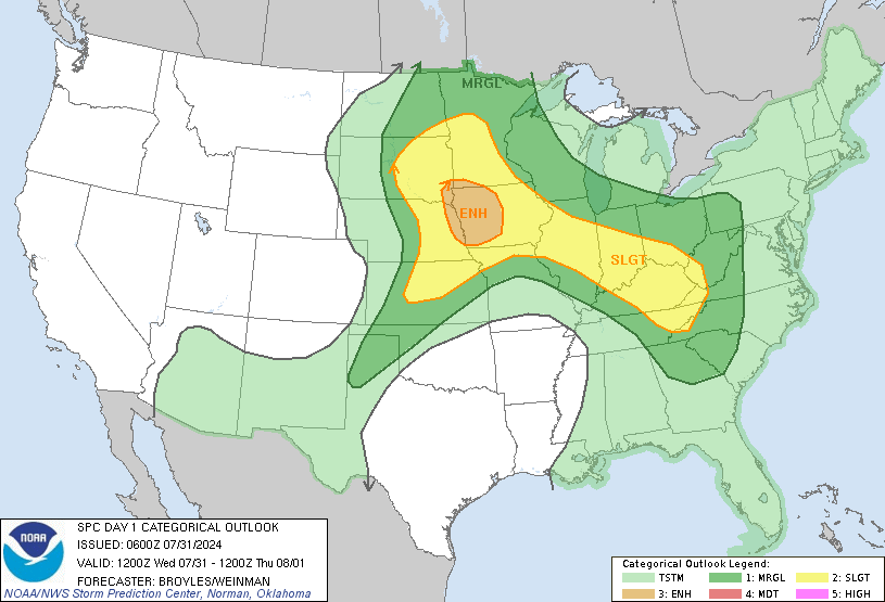
http://www.scientificamerican.com/ar...ado-prediction
Great interview.
AHF, you can be sure all of OKC will be out chasing tomorrow. Mobile internet and the radar information it provides makes it very easy to chase. Happy hunting!
PS If it were me, I'd want to on the north side of OKC by three. The real action is going to be up the I35 corridor at about that time (maybe an hour or two later) and move east from there.
Last edited by MannyIsGod; 05-24-2011 at 03:46 AM.
I wouldn't trust the RUC that far out. Look at the GFS CAPE plots instead, IMO.
http://raleighwx.americanwx.com/models.html
That will probably be better for you. The GFS plots there have better information.
EDIT, actually these forecast soundings with ML CAPE are better.
http://supercellweather.com/forecastsoundings-ok.htm
Last edited by MannyIsGod; 05-24-2011 at 03:41 AM.
Yeah, things are definitely trending northward. It looks like OKC north to Wichita, KS is going to be the sweet spot.
Will be honest, when I mentioned north Texas last night it was mainly because I didn't want to have to drive so far todayCan't get out of work before 2 or so, so we'll be confined to north Texas to Ardmore or so this evening.
And agreed on the RUC, I just wanted to throw something up that showed the potential for today.
Snipit from the Storm Prediction Center about today:
CANNOT STRESS ENOUGH THE HEIGHTENED POTENTIAL
FOR SEVERE WEATHER AND POSSIBLE STRONG TO VIOLENT TORNADOES LATE
THIS AFTERNOON INTO THIS EVENING.

Gonna be a wild day.
Be careful out there AH!
Hmmm, trying not to get excited. Looks like the Low is starting to push the dynamics to the south. Still looks like Oklahoma (in particular the Norman - Enid swath) is going to be where it's at today, but maybe the low is going to put DFW into play after all...
There should be plenty of action between OKC and Dallas. I kinda doubt with this set up you'll be hurting for cells to chase in your area
The ty part of that is that Dallas is huge and there are a lot of AHFs in Dallas. The closer you chase to a big metro area the more you're going to be stuck in traffic.
AHF, the latest run of the RUC has the 5pm MLCAPE at Ardmore near 4000. Make sure you either chase in a ty car or you stay out of the center of those supercells. If nothing else 4000 J/KG will make for huge updrafts which make for huge hail. Attack them from the SE is best, but make sure you come from the south. Going from the north you won't see without going through them.
No sooner do I make that post before I hear a rumble of thunder outside of my window. Holy its been probably since last August since I've heard thunder here in NM.
http://radblast-mi.wunderground.com/...=Hide&smooth=0
your chasing! I got this cell!
Yeah, my buddy and I like our cars. We prefer to hang to the south of storms and come in on the back end of them to stay out of the hail cores. Probably means we miss some action, or end up falling behind trying to chase storms that are hauling ass at like 50-60 miles an hour, but it beats a new windsheld / totalled car...
Latest from the SPC:
http://www.spc.noaa.gov/products/outlook/day1otlk.html
AN INTENSE OUTBREAK OF TORNADOES AND WIDESPREAD SEVERE
THUNDERSTORMS IS EXPECTED LATER TODAY OVER PORTIONS OF KS/OK/TX
PRESENT INDICATIONS AND LATEST OPERATIONS/MESOSCALE MODEL GUIDANCE
INDICATE THAT DISCRETE SUPERCELL THUNDERSTORMS WILL FORM ALONG THE
KS/OK DRYLINE BY MID AFTERNOON AND MOVE RAPIDLY NORTHEASTWARD WITH A
RISK OF A FEW TORNADOES AND VERY LARGE HAIL. EARLY IN THE
EVENT...THE GREATEST TORNADO THREAT WILL BE OVER KS AS STORMS
INTERACT WITH PRE-EXISTING OUTFLOW BOUNDARY AND BACKED LOW LEVEL
WINDS.
AS THE AFTERNOON PROGRESSES...CONTINUED HEATING AND LARGE SCALE LIFT
DUE TO APPROACHING UPPER TROUGH MAY LEAD TO MULTIPLE ROUNDS OF
CONVECTIVE DEVELOPMENT ALONG THE DRYLINE. THESE STORMS WILL ALSO
TRACK ACROSS THE HIGH RISK AREA DURING THE EVENING. LOW LEVEL WINDS
WILL BE STRENGTHENING...WITH ALL CONDITIONS FAVORING THE POTENTIAL
FOR LONG-TRACKED STRONG/VIOLENT TORNADOES AND VERY LARGE HAIL OVER
PORTIONS OF NORTH TX...CENTRAL OK...AND CENTRAL KS.
yeah today definitely looks like it will be another major tornado outbreak. This is the 4th time they've issued a high risk warning this year. Here are the other three times
Apr. 16: "Carolina Outbreak" (69 tornadoes...32 in NC...13 in VA...26 killed)
Apr. 26: "Mid-South Outbreak" (56 tornadoes....1 killed in AR)
Apr. 27: "Southeast Outbreak" (232 tornadoes...315 killed)
There are currently 1 users browsing this thread. (0 members and 1 guests)
 Posting Permissions

