
 Reply With Quote
Whoa.....living life on the edge.......

In fact I doubt it, but I know for a fact it affected the impact.


Whoa.....living life on the edge.......

So sea level was rising linearly well before mass production of autos. Thanks
Good thing this 1938 storm didn't hit
http://en.m.wikipedia.org/wiki/1938_...land_hurricane
160 mph winds. 600 to 800 dead
You can even admit AGW caused sea level rise as a factor in the flooding. So good.
PS Made this thread just for you, Darrin. Thanks for living up to my expectations.
PPS CO2 emissions and AGW didn't begin with the car.
That part of the country was overdue for this kind of storm, based on historical data. Did SUV's and cow farts make it worse? Who knows. The error is pretending to know.
Darrin doesn't deny that the Earth is warming but rather just every logical effect of a warming Earth. What hmmm. more heat applied to ice......

So predictable.

Still, nobody has proved the levels of AGW vs. natural warming.
I hope you aren't responding to me, as saying that a guest blog is proof...
Does this mean Kevin Costner is going to save us?
He already has:


Sea level has been rising certainly since the end of the last ice age...
But It's not just that... It's higher on the east coast by 3 to 4 times than the world average
How all of this relates to people... I have no idea... but whatever... that's never stopped the people that have made these arguments before...
http://www.popularmechanics.com/scie...han-the-worlds
Why New York's Sea Level Is Rising Faster Than the World's
Sea level is rising around the world, but in many places on the U.S. East Coast, it's rising considerably faster than elsewhere. An oceanographer studying this phenomenon explains.
By Amanda DeMatto
Comments
6
Share
July 9, 2012 12:00 PM TEXT SIZE: A . A . A
A team of U.S. Geological Survey scientists recently discovered that the sea level along the East Coast of the United States, particularly a 600-mile stretch from Cape Hatteras, N.C., to Boston, has risen at an annual rate three to four times faster than the global average since 1990.
When the global sea level rose by 2 inches, Norfolk, Va., saw a rise of 4.8 inches, Philadelphia answered with 3.7 inches, and New York City 2.8 inches, according to the study, which was published in the journal Nature Climate Change. Peter Howd, an oceanographer and co-author of the study for the U.S. Geological Survey, helped illuminate just why the East Coast is in the wrong place at the wrong time. It's complicated, but the short version is: The Gulf Stream might be slowing down.
Ocean Currents
Early European explorers didn't cut straight across the Atlantic Ocean in their quest for the New World because it was impossible, for the same reasons that flight paths destined for the United States from Europe are northward and curvilinear. The Earth's spin and temperature gradients cause the winds that travel over the Northern Atlantic Ocean to move in a clockwise pattern, dragging the waters below along a similar pathway.
Because of the Earth's rotation and friction in the water column, Howd says, water on the ocean's surface is transported approximately 90 degrees to the right of the direction the wind is blowing. This rerouting of the water toward the center of the ocean basin is called Ekman transport. If the wind is blowing to the north alongside the East Coast, for example, the water transport will be to the east. For winds blowing westward from North America to Europe, the water will move to the south. For winds blowing south along the European coastline to Africa, the water moves west, and so on.
The result of this physical churning might defy human imagination: It creates a huge pile of water, roughly 700 miles wide and 2000 miles long, that stands about 3 feet taller than the waters in coastal areas. "This pile of water roughly coincides with the Sargasso Sea," Howd says. The Sargasso, located in the middle of the Atlantic, is the only sea without a shoreline; it's created by these ocean currents and ac ulates a high concentration of non-biodegradable plastic waste, similar to the Great Garbage Patch in the Pacific.
It seems counterintuitive for the ocean to have a big hump out in the middle. So what's keeping that pile of water in the center of the ocean and away from our coastlines is a fine balance between the velocity of the circular ocean currents and the Coriolis effect, which describes how objects move as a result of the earth's spin. "Water likes to be flat," said Dr. Howd. "As gravity pulls that water down and tries to get that bump to smooth out, Coriolis takes over. Water will want to flow downhill to the East Coast, but Coriolis will divert its flow to the north, producing a western boundary current known as the Gulf Stream."
You've no doubt seen the Gulf Stream on TV weather maps. It's a fast plume of warm water that moves from its starting point in the Caribbean northward along the eastern coast of the United States and tapers out near Newfoundland, heading in the general direction of Europe. According to the National Oceanic and Atmospheric Administration, the Gulf Stream flows 300 times faster than the Amazon River. The flow is fastest near the surface, peaking at 5.6 mph, and reaching 4 mph on average. It transports 4 billion cubic feet of water per second, surpassing all the rivers in the world combined.
The Gulf Stream is a powerful shield for the East Coast. The faster it moves, the more water will get deflected to the Sargasso Sea and sucked away from the coast. But if the Gulf Stream slows downand scientists believe this is happening as climate change progressesthen more water will travel down from the Sargasso Sea to that 600-mile swath of coastline from North Carolina to Boston. Howd says the slowing of the Gulf Stream is a major reason East Coast sea levels have been rising at an annual rate three to four times faster than global averages.
The pile of water in the center of the North Atlantic Ocean Basin is more or less at the mercy of global temperature distribution, which drives wind speeds and wind circulation patterns, Howd says. "If the temperature goes up, it results in enough changes that the Gulf Stream slows down, surprisingly enough, and sea level will rise on the East Coast as a result."
Bouncing Back
Another reason that the East Coast is a victim of accelerated sea level rise is because the land is still readjusting from the Last Glacial Maximum. About 20,000 years ago, an ice sheet that was up to 2 miles thick in some places covered most of Canada, extended over much of the Midwest, and stretched east all the way to New York City. "The weight of that ice pushed coastal New England down. When it went down, the area to the south went up. It's kind of like squeezing a water balloon," Howd says.
Relieved of that ice-sheet load, the land is puffing itself back out in some regions north of New York City and settling back down in locales south of the city. Howd says this glacial isostatic adjustment is still occurring along the East Coast, inviting accelerated sea level rise, "stress on salt marshes and on areas with chronic beach erosion problems," and more frequent "winter storm flooding from the ocean." The simultaneous rise in sea level and sinking of the landmass south of New York City may account for this accelerated rate of change.
Read more: Why New York's Sea Level Is Rising Faster Than the World's - Popular Mechanics
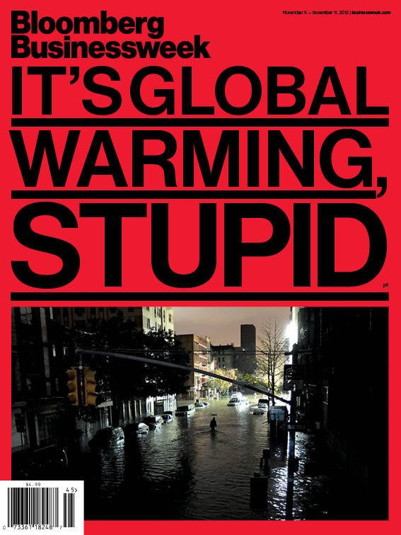
Its pretty much impossible to say that a good amount of sea level rise is not the direct result of anthropogenic heating due to melting of land ice and thermal expansion of the seas. Sandy was a strong - and probably once in a lifetime - storm but as sea level rises you will get Sandy type flooding with even weaker storms. This is a very real aspect of climate change that has serious implications for coastal cities going forward. You can talk all you want about global climate models and what the changes will actually be but this one is absolutely undeniable.
Yeah it's pretty scary. At the current rate New York city will be underwater in 3500 years.
Dupe.

that's Nick Cage.

Yes, the absence of hurricanes is big news. Romney should be reminding us every day. It's a winning strategy.While it's hardly mentioned in the media, the U.S. is currently in an extended and intense hurricane "drought." The last Category 3 or stronger storm to make landfall was Wilma in 2005. The more than seven years since then is the longest such span in over a century.
"Humans do affect the climate system, and it is indeed important to take action on energy policy"
oops, did Darrin mean to post this?
"effective forecasts"
For Representative Ryan’s plans for NOAA in the FY 2013 budget, see here:
NOAA’s programs are in function 300, Natural Resources and Environment, along with the U.S. Geological Survey (USGS) and a range of conservation and natural resources programs. In the near term, function 300 would be 14.6 percent lower in 2014 in the Ryan budget according to the Washington Post. It quotes David Kendall of The Third Way as warning about the potential impact on weather forecasting: “‘Our weather forecasts would be only half as accurate for four to eight years until another polar satellite is launched,’ estimates Kendall. ‘For many people planning a weekend outdoors, they may have to wait until Thursday for a forecast as accurate as one they now get on Monday. … Perhaps most affected would be hurricane response. Governors and mayors would have to order evacuations for areas twice as large or wait twice as long for an accurate forecast.’”
http://www.economonitor.com/blog/201...fema-and-noaa/
Humans do affect the climate system, and it is indeed important to take action on energy policy
Oops
Who says humans DON'T affect the climate system?
Ooops. Shows how much I watch movies.
There are currently 1 users browsing this thread. (0 members and 1 guests)
 Posting Permissions